See the future unfold
Welcome to The NEA Vision Tool ©
The NEA Vision Tool has been designed and built as a part of the Nordic Network for Electric Aviation project organization, sponsored by Nordic Innovation, an organization under the Nordic Council of Ministers. The purpose of the tool is to capture a visual representation of airports and aviation patterns, in the Nordics, as they occur today, and to provide an outlook of what can be possible with the introduction of electric aviation. It is built to inform and inspire. As a user of this free NEA Vision Tool, you can build your own vision for electric aviation. The tool in itself is a visionary tool, without the answer of the future aviation patterns.

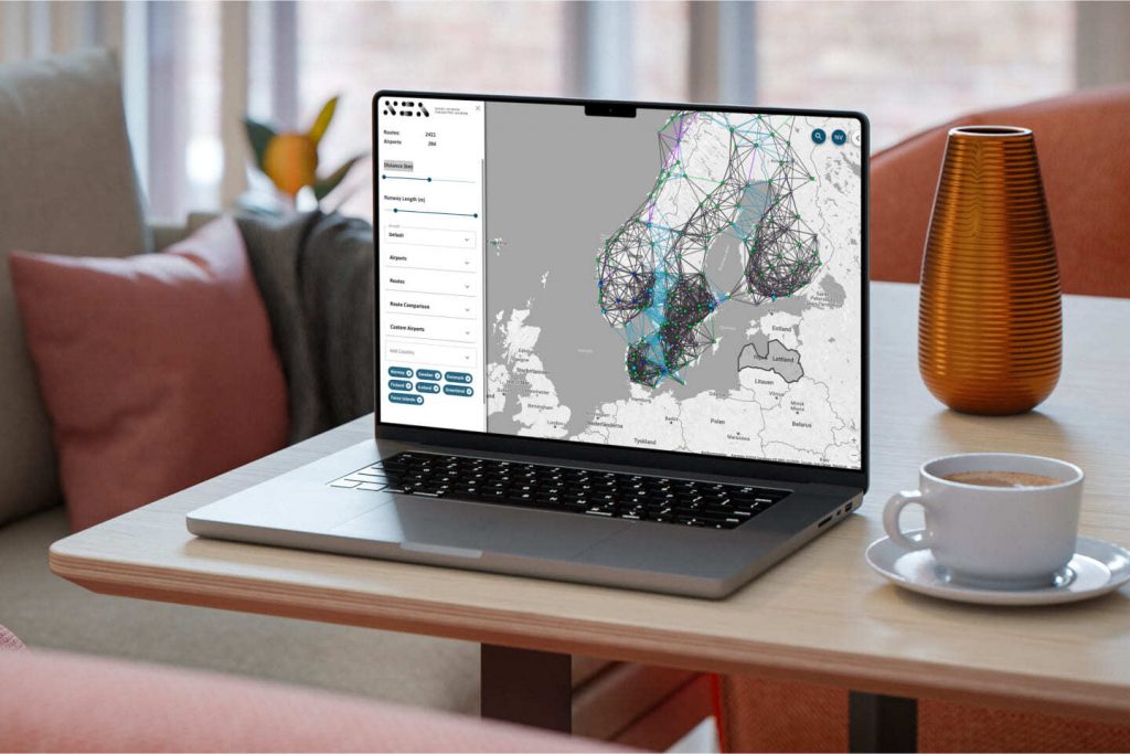
The NEA Vision tool is a web-based map solution that plots existing airports and routes, but also visualizes routes that are feasible given criteria and filters that you can define by yourself. The results are both visualized in a map and an analytics view with dynamic lists and graphs.
With this tool we present all the available data in an understandable format. It provides a base for discussion, but also gives us some answers
Eirik Sandal, Co-Founder of Elfly Group
Start using the tool today!
Enjoy the free capabilities, and keep in mind that this is a tool still under development. We love feedback, so please give us feedback on how you like it, if you find any flaws, or would like new features. You can find a link to provide feedback at the bottom of the left menu in the tool.
Case Study: Visby Airport at Gotland
As the tool was officially launched at Gotland during the Flightplan ‘24 conference in November 2024, we have included a short case study focusing on their local airport in Visby.

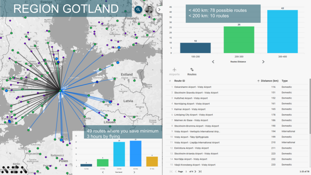
The diagram above shows extracts from views in the tool using a filter on a flight distance of 400 km and with Visby Airport as the focal point.
Data sources
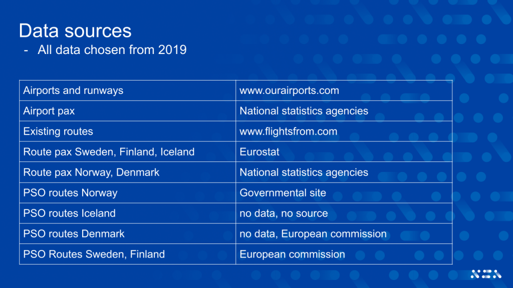
We have mostly used data from 2019, before the pandemic. The diagram below shows the sources used:

We have also acquired data from Google to calculate alternative travel time such as car or public transport including buses, ferries, and trains. This enables you to compare travel time from city center to city center both via electric flight or other alternatives.
Copyright
The NEA Vision Tool is copyrighted by The Nordic Network for Electric Aviation. Please credit “NEA Vision Tool by The Nordic Network for Electric Aviation”, when using it for presentations, articles or other types of publications.

